Thu 08 Jul 2010 13:21 » Jon
Mountain lakes can be a little chilly at times. Klaas and I are currently paused by one called Lac des Isclots, which is fed by a glacier and a large number of snowfields. When we decided to camp here we’d wondered about being able to wash or swim in the lake, but I’d only walked out far enough to cover my knees before my feet were so painfully cold that I had to go back to the shore. I tried swimming in a similar lake once and took one stroke away from the shore before realising I might just freeze solid and die - I’m not making that mistake again.
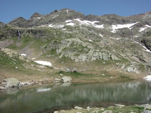
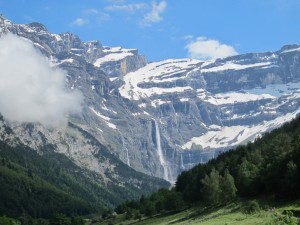
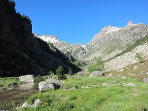
Luckily there’s a stream by our bivouac site (1st photo), so we’ve washed ourselves and our clothes in that. We’ve also eaten the sandwiches we got from the refuge and done some maintenance - waxing boots, sewing up holes in sleeping bags etc. People often asked what I’d do in the evenings, especially when I was on my own, but there’s loads to do: pitch tent, wash, cook, eat, wash clothes, plan route, get kit ready for next day, write diary, write blog, etc. The last few days we don’t seem to have had any time to relax, so it’s nice to have an afternoon off.
We’re so remote up here that we’ve stopped bothering to purify or filter the water. We passed some snow-sheep (a strange breed of sheep that appears to live on snow, rather than grass) on the way up but the only thing we’ve seen at this altitude is a marmot, so hopefully he hasn’t polluted our stream too much.
Just beyond the sheep was yet another swollen river that we had to cross. Time and again we’ve come to stepping stones which are totally submerged and useless due to the amount of snow melting. Sometimes we’ve managed to find an alternative crossing, but occasionally there’s no choice but to wade. Klaas takes a different approach than me - he went through a river the other day in his boots, while I prefer to keep everything as dry as possible. This particular river was up to our thighs and flowing pretty quickly, so it was a good thing we had the poles for balance - the power of the river could easily have knocked us over, which would have been bad news for the rucksacks!
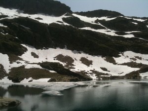
While the lake here is barely above freezing (and I mean that literally - the second photo shows ice floating in it), the temperature in the sun is ridiculous. Finding shade is very difficult too - the sun is almost directly overhead, so I’m currently curled up in a little hole in a north-facing cliff!
Wed 07 Jul 2010 19:41 » Jon
One of the most impressive things we’ve seen so far is the destruction caused by avalanches. Every now and again we’ve been walking along the side of a hill and have come to a stripe down the mountain where all the trees are broken off at the stumps, while down at the bottom of the slope there’s a big pile of rocks and trees and sometimes still some snow. It’s hard to imagine seeing it happen - watching a band of trees, sometimes several hundred metres wide, being wiped out in a matter of seconds.
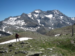
We passed one of these stripes of avalanche destruction yesterday morning on the way down to Parzan. My rules prohibit hitch-hiking but Klaas is more flexible, so while I walked 5km down the road he got a lift to the village and picked up some supplies. We then met up and began a long, hot and sweaty climb up to Paso de los Caballos (2,314m), before descending to a campsite at Biados.
The last two days have been much hotter than earlier days - no wind and very few clouds - so the climbs have been pretty tough. Above about 2,000m the temperature drops quite noticeably, especially if there’s a lot of snow, but climbing out of the valleys has been hard work.
Today’s climb was off-piste - we left the GR11 and had to make our own way up to Porte des Aygues Tortes (2,683m). While the GR10 and GR11 are waymarked, the HRP isn’t. Sometimes it follows another trail, so there may be markings, but sometimes there’s not even a path, as was the case today.
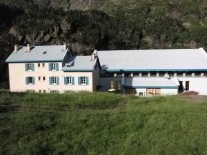
The climb was steep, sometimes on snow but mainly on scree. The descent though, was a north face, and was almost all snow. We lost quite a lot of time against the guidebook’s estimate, as it wasn’t expecting any snow at all, so despite what should have been a short day, we arrived at Refuge de la Soula after 7pm.
The refuge isn’t one of the most picturesque, as it seems to have been converted from part of an HEP station. The power station is literally a few metres away and, with a typically French regard for health and safety, they’ve left the door open!
Klaas and I are both feeling a bit knackered so we’re going to split tomorrow into two, giving ourselves two easier days. We’ve taken advice from various people and it sounds like the HRP is doable, so we made our choice when we left the GR11 earlier today. We’re now committed to the HRP, on the understanding that we’ll turn back if it gets too dangerous.
Mon 05 Jul 2010 17:32 » Jon
In the next 36 hours, Klaas and I need decide whether we’re going to tackle the toughest 3 days of the HRP or take a diversion onto the GR11, on the grounds that the current snow levels make the HRP too dangerous. I mentioned yesterday that I was trying to convince Klaas to join me on the HRP but, after I’d written that last night, we read his guidebook. Whereas mine says the route may be dangerous in bad weather, the Véron guide suggests a rope might come in handy and isn’t very positive about the chances of survival even then.
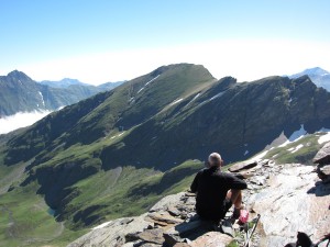
This morning I wandered over to his tent to tell him I was reconsidering and he said he’d changed his mind too. We agreed to have a chat with the guardians of the two refuges en route, and see what their advice was, given the amount of snow currently around. At that point though, it looked like we were heading for the GR11.
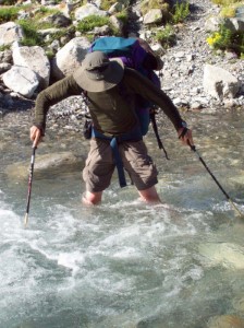
We had a late lunch at Refuge de Barroude and asked the guardian there what he thought. We’d just come over a col called Hourquette de Héas, so we were relieved when he told us that it was no worse than that. There was a bit of steep snow on the descent and some slightly precarious rocks to cross, but nothing too bad.
Tomorrow night we’re thinking of camping on a campsite slightly short of the second refuge, so we should get a second opinion early on Wednesday morning, then we need to decide.
After our lunch at the refuge we had another snowy climb up to Puerto de Barrosa, then crossed over into Spain and spent a couple of hours descending into the valley. The river was much higher than the guide book expected, and was quite tough to cross. I tied my boots to my pack again, but Klaas waded through in his boots, and is now hoping they dry out by tomorrow!
Shortly after we crossed the river, we made it safely to our bivouac spot by the river. Apart from having the world’s most aggressive mosquito population, the place is pretty nice, but I’d got 20 bites swelling up before I realised what was happening, and have been hiding in my tent since then.
I did venture out for a sip of Heineken at one point. Klaas picks up a can or two every day, as close as possible to the end, then chills them in a stream when we’ve arrived. Carrying the extra weight seems a bit mad, but I can’t deny that it tasted absolutely amazing last night! I might even get myself a can this afternoon…
Sun 04 Jul 2010 18:53 » Jon
After a couple of nights partying in Gavarnie, it was back to work today. The gang split up, with The Felice and Ryan Show heading south in search of the Odessa National Park, while the newly formed Anglo-Dutch partnership headed east.
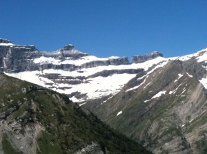
It was quite sad last night saying goodbye to the other guys. From here on we reckon we’re less likely to meet again, though they’re hoping to end around the same time as me, so we may see each other in Banyuls.
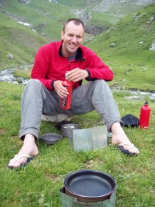
After two and half weeks of walking on my own I was a bit wary about having to fit in with someone else’s pace and stop when they wanted to, but Klaas and I seem to walk at a very similar speed, so that was a relief. My strategy for having breaks is pretty random, but probably works out at 10 minutes every hour and a half or so. Klaas tends to walk for longer then have bigger breaks, but that seemed to work ok too.
We made excellent time today, easily beating the guidebook, so carried on 1:15 into tomorrow’s route. Tomorrow was supposed to be a 10-hour 1,500m day, so it’s good to have knocked off 400m climb already.
It’s also nice to have someone else around. At the moment Klaas is planning on heading north to do some of the GR10 on Tuesday, so I’d be solo again for several high, snowy days, with three of the four “extreme” grade days back to back. However, there were early signs today that I might be able to convince him to join me, so we’ll have to see how that pans out! I’d be a lot happier on those snowy sections knowing I had someone looking out for me, and I’m pretty sure Klaas would enjoy it more than the dull old GR10…
Sat 03 Jul 2010 07:20 » Jon
At the end of the first stage I arrived in Lescun and the first people I met were the American couple, Ryan and Felice, looking for an internet outside the post office. Yesterday I popped into the Office de Tourisme in Gavarnie to find somewhere to stay, and they’d finally found the internet, courtesy of Gavarnie’s single networked PC. They immediately accused me of being Klaas’s friend and told me he was waiting for me at the campsite, which made me feel a bit bad as I’d already decided to stay in a hostel, due to the weather forecast.
I felt even worse about 10 minutes later when, having had no luck with the hostels, I checked into a hotel, but it’s sooo nice to have a bed, sheets, soap, a towel… I’ll never take these things for granted again! After weeks of washing my clothes in streams I’ve also taken advantage of the clothes-washing service - once I’d showered, my clothes felt so dirty I wanted to wash my hands after just touching them! Although I promised I wouldn’t blame them, it’s actually Ryan and Felice’s fault - their idea is to have a hotel for the rest days, which seems like pretty sound planning to me. I’m sure it’ll help the body recover better ready for the next stage.
What won’t help is what happened next. Having finally picked up the iPhone charger from the post office (thanks Mum and Dad!) and sent the useless solar chargers home (no thanks to Powertraveller) I joined Ryan, Felice and Klaas to watch the Dutch beat Brazil. We had a few Leffe during the match then Klaas was overcome with the emotion of watching his team beat the favourites and ended up buying the booze for our meal. The restaurant owner added some complimentary génépi into the mix and we followed that with more beer as we watched the second match of the day on the world’s smallest TV. So much for a recovery…
Today is a rest day, which means food shopping, checking the route for the next stage, and maybe even using the internet if I can somehow get there before Ryan and Felice. It turns out that the reason they’re so keen on it is also a blog, but they don’t have the luxury of an iPhone to post endless updates from the mountains.
Another person making good use of the internet is Mark, the Welsh guy I met a couple of days ago. He’s kindly posted some photos he took of me from Col des Mulets.
Fri 02 Jul 2010 15:25 » Jon
The second section of the HRP came to an end today, with a great climb from Refuge des Oulettes de Gaube, followed by a dull descent into Gavarnie.
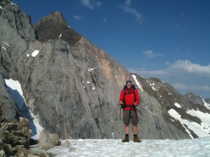
I left the refuge at 07:40 for the climb up to Hourquette d’Ossoue (2,734m) with a few early morning clouds clearing, but the weather didn’t seem to be able to make up its mind and the clouds came back as I progressed. The route from the refuge was on the GR10 all the way to Gavarnie, so was easy to follow until the snow, but even then there were some footprints. Remembering Mark’s advice, I ignored the crampons and made as much use as I could of the islands of rock, but as these ran out I put the crampons on and headed over the col (photo), meeting a couple of people coming the other direction. The snow went all the way down the other side to Refuge de Baysellance, which I reached shortly before 10:00.
The first part of the descent crossed the occasional snowfield, some quite large and one covered with sheep, who all looked a bit confused! The route flattened out at a reservoir, where I met a French guy I’d spoken to at Pombie and Arrémoulit. We discussed our routes over the last few days and he announced “vous avez marché bien!”
Beyond the dam there was a choice of road or path. Mark had recommended the road and the French guy took this option, but I decided the GR10 might be easier on the knees and feet, and had to be more interesting than the road! When I heard a rumble of thunder I wished I’d taken the road, but the rain held off and eventually I descended into Gavarnie, looking forward to another rest day.
Thu 01 Jul 2010 14:18 » Jon
Because there’s a lot more snow around than usual, there’s also a lot more water in the stream and rivers. The path I was following came to a crossing after about 30 minutes this morning, but the water was way too high to cross. Someone had kindly placed some big metal pipes every couple of feet and piled rocks between them to try and create some stepping-stones, but the entire construction was under water.
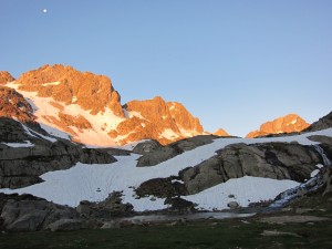
One of the things Andy and I learnt on our recent trip to Dundonnel was that river crossings can waste a huge amount of time if you keep looking for the perfect place, so it wasn’t long before I decided to wade across bare-footed. It felt like it added about 20 minutes once I’d put the important things in dry bags, tied my boots onto the top of my bag, waded across the freezing melt-water and put my boots back on - by the time I’d found a way down to Refuge de Wallon it was 1:40 from where I’d camped.
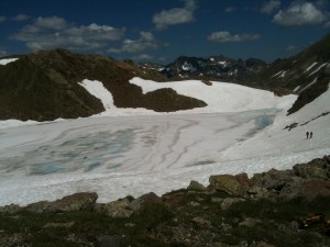
The day’s climb began shortly after Wallon with a pleasant path up to Lac d’Arratille at 2,247m, then the snow began again. I didn’t bother with the crampons to begin with as there were big rocky areas between the snow, but around 2,350m I switched to crampons and climbed up to Col d’Arratille. This time there were obvious recent tracks, and meeting someone coming the other way increased my confidence. I met a French couple at the top (the second photo shows them heading down the way I’d come) and set off towards the next challenge - Col des Mulets.
The path to the col was a long traverse along some steep scree slopes, with gullies full of snow every now and again. I did the first few of these without crampons, then thought it would be a bit dumb if I fell while carrying the crampons so used them for a couple of the bigger gullies.
As I paused for a bite to eat, a couple caught me up and I heard English being spoken. They turned out to be a Welshman (Mark) and a Mackem (Heather), but despite this they were very friendly! We chatted for a while and Mark suggested most of the stuff could be done without crampons - all he had was a single wooden stick. He also mentioned that he owns the domain lescun.com, so I told him he’d make millions if he opened up a little internet cafe there.
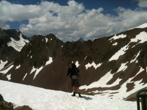
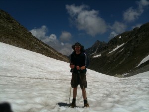
They left me to eat a few oatcakes then I followed them up to the col (without crampons) and caught them up at the top, where Mark took the third photo, below. We walked down to Refuge des Oulettes de Gaube together, debating everything from the amount of snow (which is apparently what they’d expect at the beginning of June rather than July) to politics to the logistics of running a cafe in Lescun, then they stopped for a late lunch and I checked into the refuge.
Tomorrow I’m hoping to reach Gavarnie for my second rest day, but first I have to climb over to Refuge de Baysellance which I should have done at the end of today. In the book it’s down as taking 2:20, but the guardian here reckons 3:00 because of the snow, and crampons and axe will definitely be required…
Wed 30 Jun 2010 17:22 » Jon
When I was writing about Port du Lavédan yesterday I didn’t mention a minor injury to my foot, as it didn’t seem important at the time. I’d been standing almost still and my left boot had slipped between 2 rocks, one above the other, so the side of my foot had been squashed between the rocks. I’d sworn at the time and thought how painful it was, then carried on.
In the middle of the night I woke up and the foot was in agony. Any pressure on the side of the left foot was excruciating, and when I tried standing up I thought the walk was over. At 01:15 I wrote in my diary that I thought I must have broken a bone and had got down to the refuge on pure adrenaline. I took a load of painkillers, lay there thinking how lucky I was to have made it to a refuge where we could call for a helicopter, and began planning what I’d do when I got home.
This morning I didn’t bother getting up in a rush as I knew I wasn’t walking. When I did finally drag myself out of the tent I was surprised that it didn’t feel as bad as last night. I wandered slowly over to the refuge and began wondering whether I might be able to carry on after all. In the end I took a load more painkillers and set off, and although it was sore for the first hour or two, it now feels fine. All very strange.
As a result of lying in bed feeling sorry for myself, I didn’t leave till 08:50, which wasn’t clever as the day had 8:15 of walking, not including stops.
The main feature of today was a huge climb (over 1,100m) from the bottom of the valley I was in last night up to Col des Cambalès at 2,706m. The guidebook mentioned that there might be some snow near the top in early summer, but no-one had mentioned the climb in any of the discussions I’d had in the last week about routes being closed, so I’d assumed the snow wasn’t too much of am issue.
As it was, I hit occasional snowy gullies from about 2,000m and permanent snow from about 2,150m, before I’d even reached Port de la Pèyre Saint-Martin. There were some obvious tracks across the snow that far, and when I began climbing on towards the col there were still a few, but these seemed to gradually disappear (I guess tracks from a day or two ago can easily melt) and pretty soon I was on my own.
This turned out to be a bad thing, as I began climbing up the wrong gully. After a while I realised things were not matching up with the map, so took a GPS reading. Just like yesterday the numbers were out, but this time it was my fault.
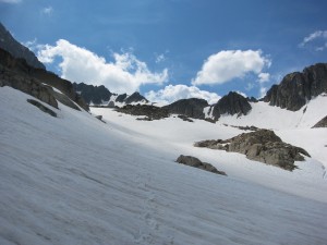
It took me ages to get back down the gully and around to the right one. I was already a bit worried about starting so late, as the snow had had the sun on it all day and was pretty soft, so adding an extra hour or so didn’t help.
The correct gully wasn’t too long, but it was very steep. I ended up front-pointing quite a lot of the time, which I hadn’t been expecting. Unlike yesterday’s mission the cloud didn’t complicate the descent - I dropped down about 400m on the snow then took the crampons off and hopped over boulder-fields down to 2,250m.
I’d realised some time ago that getting to the refuge was going to mean a late end, and since I wanted to camp it didn’t seem too important, so I’ve stopped an hour or so short, which I should be able to make up tomorrow or Friday before I reach Gavarnie.
At the moment I’m feeling quite intimidated by the snow. As well as the obvious danger of sliding, there are extra complications caused by the snow melting around rocks (so much so that one could suddenly fall several metres), rivers running under the snow, and in my case it seems, navigation. This last one should be pretty easy to fix, and I guess confidence regarding the rest will come with experience.
Tue 29 Jun 2010 16:59 » Jon
The guidebook I’m using gives each day a grade to indicate how hard it is. Grade 3 is a short easy walk, grade 2 is a “classic HRP day” with a fair amount of ascending and descending, and grade 1 is “suitable only for experienced, well-trained mountaineers.” The vast majority of days are grade 2, with a few of grades 1 and 3.
There is a fourth grade, E, which stands for extreme. There are 4 of these, and today was the first. I’d been looking forward to it, as it was the first day that involved serious snowfield crossings, but I’m no-longer looking forward to the others!
Given the length of the day, I dragged myself out of bed soon after 06:00 and set off about 7:45. My times were pretty good and I reached Col d’Arrious soon after 12:00, having climbed over 900m from the valley I’d crossed.
Shortly after the col there’s some via ferrata - a section of path up the side of a cliff, where they’ve put a cable for people to hold on to (see photo below) - called Passage d’Ortieg. I had a brief chat with an old French guy who looked troubled when I said I was about to do it. He warned me that there were icy sections, and I began feeling a pretty nervous as I approached it. Fear #1.
I stowed the walking poles I normally use and, once I’d got going, it wasn’t actually too bad. Most of the path was wide enough not to feel too precarious and I made a conscious effort not to look down!
I paused for lunch at the top of the Passage then headed down to Refuge d’Arrémoulit at 2,305m. I popped in to get some water and noticed the forecast was for storms this afternoon, so asked if it was still safe to carry on to Refuge de Larribet. The guardian replied that I should be quick, so I set off in a bit of a hurry - the last thing I wanted was to get caught in a storm while on snow at one of the highest cols I cross.
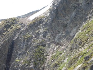
The climb to Col du Palas went pretty well, even though I could only see 2 or 3 other tracks. Once I hit the snow it took about 40 minutes on crampons to reach the top (2,517m), and although I’d swapped one pole for an ice-axe, it wasn’t really necessary.
After the col came the much talked about Port du Lavédan, which I heard on Saturday was unpassable last week. Getting there was a bit hairy, and I was glad I had the ice-axe this time. Again, there were only 2 or 3 tracks, but they looked pretty sensible so I followed them. I had to keep switching between crampons (for snow) and no crampons (for climbing boulder fields) then finished off with a big climb across a snowfield to arrive at the col (2,615m) on schedule.
As I’d been climbing up from Arrémoulit the cloud had been building high up, and fog had been moving up the valleys. The sun had disappeared for the final time, but visibility had been ok. As I crossed over Port du Lavédan though, that changed - visibility on the way down was about 10m.
The descent east looked remarkably steep, beginning with a nasty climb down a cliff. I couldn’t see any of the valley below but gradually picked my way down, rethinking my route several times when I found myself dangling off rocks I was uncomfortable with. Fear #2.
At the bottom of the cliff there was another massive snowfield. I refitted the crampons, grabbed the axe and set off down. Although I could barely see, things seemed to be going ok, but I thought I’d check my position with the GPS just to make sure I was heading the right way. I was a little surprised when the GPS coordinates were about 2km south of where I thought I was. Given that it was now after 16:00, I was on my own, I couldn’t see anything, a storm was expected, and only 2 or 3 people appeared to have done the route this year, I decided the best thing to do was get down and get off the snow, even if I was in the wrong valley. None of it made any sense though - I’d followed the map and (while I could still see) everything had fitted perfectly. I fired up the iPhone’s GPS and the map looked more sensible, but I was rather concerned as I headed down. Fear #3.
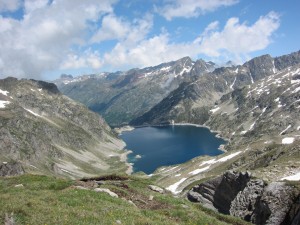
I checked the GPS after 5 minutes and it was still convinced I was 2km south of where I wanted to be, so I examined the map a bit more. I couldn’t see much of the valley due to the fog, but what I could see didn’t fit with the GPS coordinates at all.
I carried on down, crossed some more boulder fields, and came towards a lake. I checked the GPS again to see if it had come to it’s senses and it’s hard to overstate the relief I felt when I saw that the second number had switched from 47457 to 47477! It looks so simple on the screen, but those 2km had put me in the wrong valley, in the wrong country, with no path!
Once the GPS had sorted itself out most of my fears subsided. I had a few left though, involving a slip that needed a minor ice-axe-arrest, crossing a river that went under the snow and walking alongside a lake where I could see the snow had collapsed into the lake in places.
Eventually I made it to Larribet, about 90 minutes later than I’d hoped. After the day I’d had I wondered whether I deserved a bed, but since the thunder hadn’t arrived I thought I should probably camp. The refuge was empty when I popped in though, so I decided I’d have a meal there to keep the guardian company.
UPDATE: Since I got back to the UK, various friends have questioned my skills with a GPS and suggested that it was more likely to be my mistake than Garmin’s. Luckily the GPS was recording a log, and I now have evidence that the unit corrected itself at 15:39:55 (the GPS was in UK time, so it was actually 16:39 where I was) - either that, or I was suddenly propelled 3km at a speed of 537km/h. If you have Google Earth installed then this KMZ file shows where it all took place.
Mon 28 Jun 2010 14:19 » Jon
Ford Prefect almost got it right when he advised Arthur Dent that a towel was the most important thing to take with him, but personally I’d always take a face flannel if space or weight were restricted. The flannel has proved its worth time and again: you can wash with limited water supplies, e.g. using a bucket; if you want to wash in a cold stream it limits the amount of cold water splashed around and you stay warmer; in a shower where you have only 3 pushes, it adds flexibility; and of course, if you wring it out, you can use it as a towel, so Arthur would have ben fine.
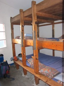
At Refuge de Pombie, where I’m staying tonight, a shower token buys you three 30 second bursts of hot water. Simply having a shower makes it better than Refuge d’Arlet where I was on Saturday, but there’s more space too - generally much more satisfactory.
I was supposed to be camping tonight, but about 30 seconds before I got to the refuge the heavens opened. For the third day in a row I was lucky to avoid the worst of it - I sprinted for the refuge and once I was inside it was hard to imagine camping being much fun. I need to kick this refuge habit though, as I can only afford one more before I reach Gavarnie on Friday.
I’m not feeling too bad about tonight though - there was a huge thunder storm during dinner with some amazing views of the lightening hitting the valleys below us (we’re at 2,031m). I didn’t manage to catch the lightening but the second picture below is of the aftermath, looking east from Pombie.
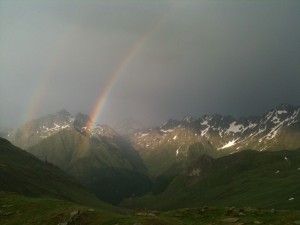
Today began very slowly, which I’m blaming on the wifi. As well as catching up on the news and a few urgent emails, I logged onto Skype and had a chat with Ez, one of the team from the original trip to the Pyrenees 14 years ago. We’d always hoped to be able to have another go at the challenge together, but he has a family and a job now so can’t just walk out for 2 months.
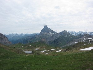
The main feature of today was a big climb around the Pic du Midi d’Ossau (1st photo), up to Col de Peyregret: 650m of steep ascent, which took just under 2 hours. It was another humid afternoon so it was a sweaty start, but higher up (the col is at 2,315m) it got much colder. There was a lot of snow near the top, but all do-able without crampons.
Last night I called Refuge d’Arrémoulit to check the snow conditions on tomorrow’s route and the guy there said it should be ok. I asked again tonight in Pombie and they agreed that it was passable with crampons. When I mentioned I had an ice-axe as well they commented “very well equipped” so I’m hoping it will all be OK. It’s a long day though, so I think an earlier start might be in order this time.


