The Final Countdown
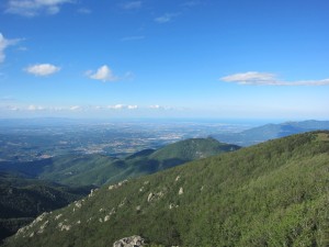
Before I left home I marked the route of the HRP on my maps and cut out the strip of the map I needed for the trail. As I’ve slowly ambled east I’ve been throwing away the used maps, and at times even tearing off the left hand side day-by-day, all in a bid to keep the weight down. The problem with this strategy is that when I look back west, it’s impossible to identify any of the peaks I can see! As I’ve dropped slowly towards the sea the last few days I’ve had some great views, and it’s been frustrating not having a big map to work out exactly where Carlit and Canigou fit in.
When I did Canigou on Sunday there were low clouds to the east, so I couldn’t see the sea, but when I climbed Roc de Frausa on Tuesday I got a fantastic (and rather emotional) view of the Mediteranean.

The weather on Tuesday was a lot better than during the descent to Arles the previous day, and I dried out the tent and clothes during various rest stops. The morning brought a 700m climb, but the day’s main feature was the 900m climb to Roc de Frausa, which took most of the afternoon.
Normally I’ve been carrying 2 litres of water, but I left Arles with 3, as it’s hotter and drier here – I’m drinking more and finding water points less frequently. Unfortunately there was nowhere to top up, and by mid-afternoon I was out. I decided I could probably last the remaining couple of hours but was very relieved to hear a little trickle of a stream not too far off the path. I gave the purifying tablets 10 minutes to work their magic and climbed up alongside the stream, noting the cow hoof-prints in the mud and hoping the water wasn’t too horrendous, then drank about half a litre straight from the bottle. I put the rest into the bag for my drinking system and was slightly disturbed to see that it was a dark yellow colour!
I avoided drinking much more, climbed over the top and dropped down into Spain, to stay in an unmanned refuge. It was part of a bigger building, but was basically just a room with a fireplace, a table and space for 12 people to sleep, all kindly provided by a Spanish mountaineering organisation. As I settled in I wondered why I hadn’t used the unmanned refuges more.
Soon after I got there a French guy showed up, doing the GR10 backwards, so 2 days into his trail. We discussed travelling solo and it turned out he was quite used to it – he spent a year and a half cycling from France to China!
Today was one of the hottest days so I was glad it was mainly downhill in the morning. It was almost all on dirt road, leading slowly down to a strange shopping hell called Le Perthus, which is currently vying with Gibraltar for second spot in the list of places I should avoid in the future. I spent about 3 hours in Benidorm once, and that was enough for it to secure first place.
After the obligatory Coke and Magnum, I set off up towards Col de l’Ouillat. I followed the book’s instructions but was a little disturbed to see the signs for the GR10 (which I was on at the time) turning off the road. The map agreed with my book, so I stuck with them, ignoring the signs.
Eventually the route I was following reconnected with the GR10′s new route, and I made a schoolboy error, turning the wrong way onto the trail. It took me five or ten minutes before alarm bells started ringing and I retraced my steps.
The climb was fairly straightforward after that and I’m now at Col de l’Ouillat, dreaming of reaching Banyuls tomorrow.

